Презентация к уроку английского языка "Great Britain. Geographical position"; 10 класс


Слайд 1
. Сабақтың тақырыбы/Тема/Theme: Great Britain. Geographical position
Слайд 2
Слайд 3
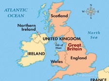
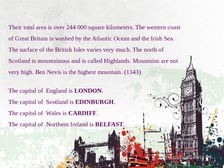
Their total area is over 244 000 square kilometers. The western coast of Great Britain is washed by the Atlantic Ocean and the Irish Sea. The surface of the British Isles varies very much. The north of Scotland is mountainous and is called Highlands. Mountains are not very high. Ben Nevis is the highest mountain. (1343) The capital of England is LONDON. The capital of Scotland is EDINBURGH. The capital of Wales is CARDIFF. The capital of Northern Ireland is BELFAST.
Слайд 4
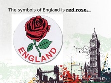
The symbols of England is red rose.
Слайд 5
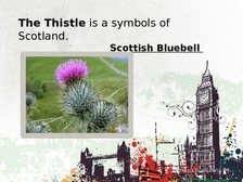
The Thistle is a symbols of Scotland. Scottish Bluebell
Слайд 6
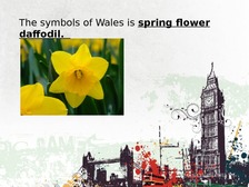
The symbols of Wales is spring flower daffodil.
Слайд 7
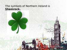
The symbols of Northern Ireland is Shamrock.
Слайд 8
Слайд 9
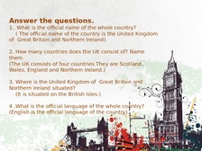
Answer the questions. 1. What is the official name of the whole country? ( The official name of the country is the United Kingdom of Great Britain and Northern Ireland). 2. How many countries does the UK consist of? Name them. (The UK consists of four countries They are Scotland, Wales, England and Northern Ireland.) 3. Where is the United Kingdom of Great Britain and Northern Ireland situated? (It is situated on the British Isles.) 4 .What is the official language of the whole country? (English is the official language of the country).
Слайд 10
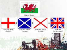
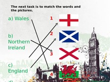
The next task is to match the words and the pictures. a) Wales 1 b) Northern Ireland 2 3 c) England 4
Слайд 11
REFLECTION tairs of success»

Полный текст материала Презентация к уроку английского языка "Great Britain. Geographical position"; 10 класс смотрите в скачиваемом файле.
На странице приведен фрагмент.
Автор: Утельбаева Диляра Асимгалиевна  Публикатор
16.11.2017 0 5979 390

Спасибо за Вашу оценку. Если хотите, чтобы Ваше имя
стало известно автору, войдите на сайт как пользователь
и нажмите Спасибо еще раз. Ваше имя появится на этой стрнице.


А вы знали?

Инструкции по ПК